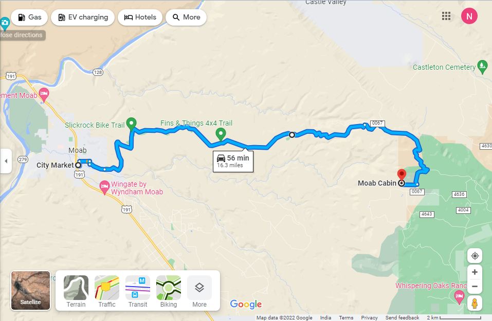
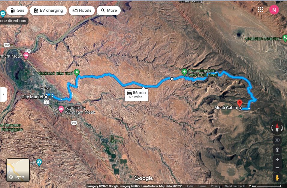
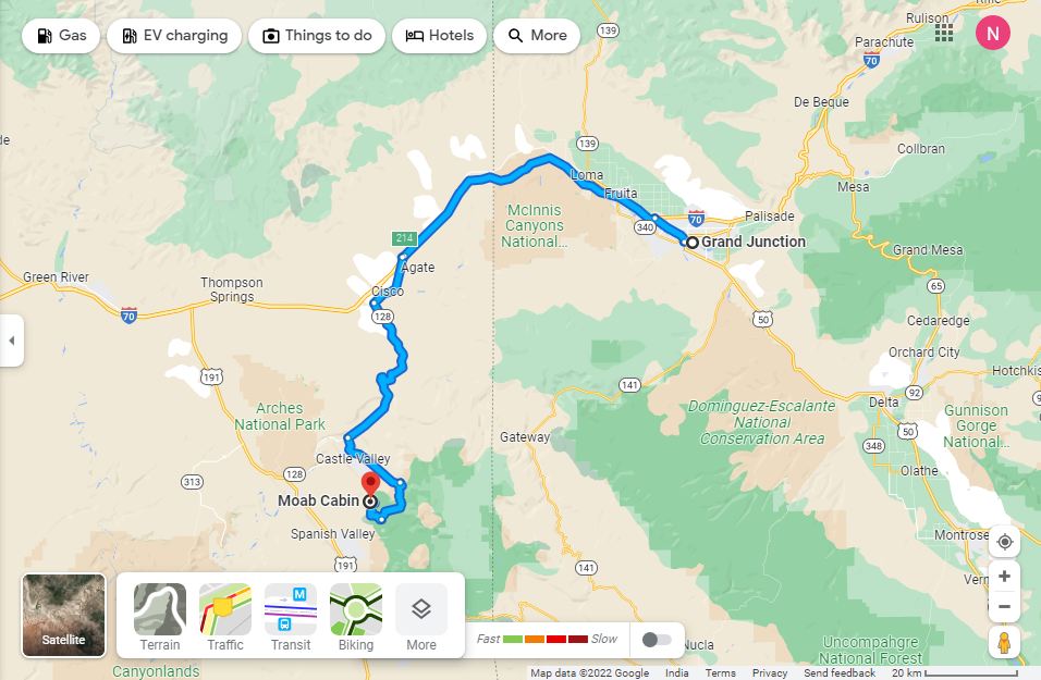
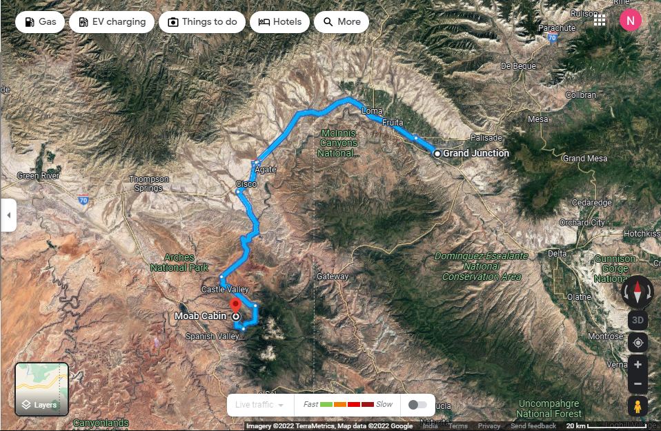
Map Of The Area
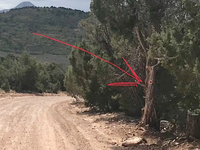
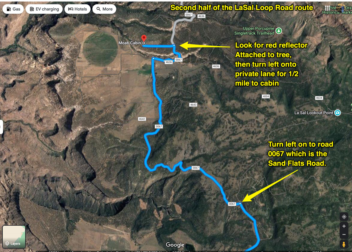
Reflecter indicating cabin lane on your right in 70 feet from the East on SandFlats road starting at Slick Rock.
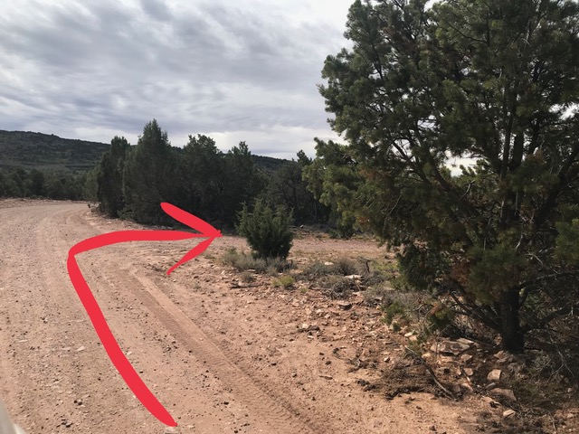
Turn into the Lane from the East on SandFlats road starting at Slick Rock
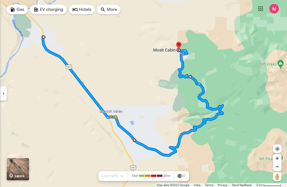
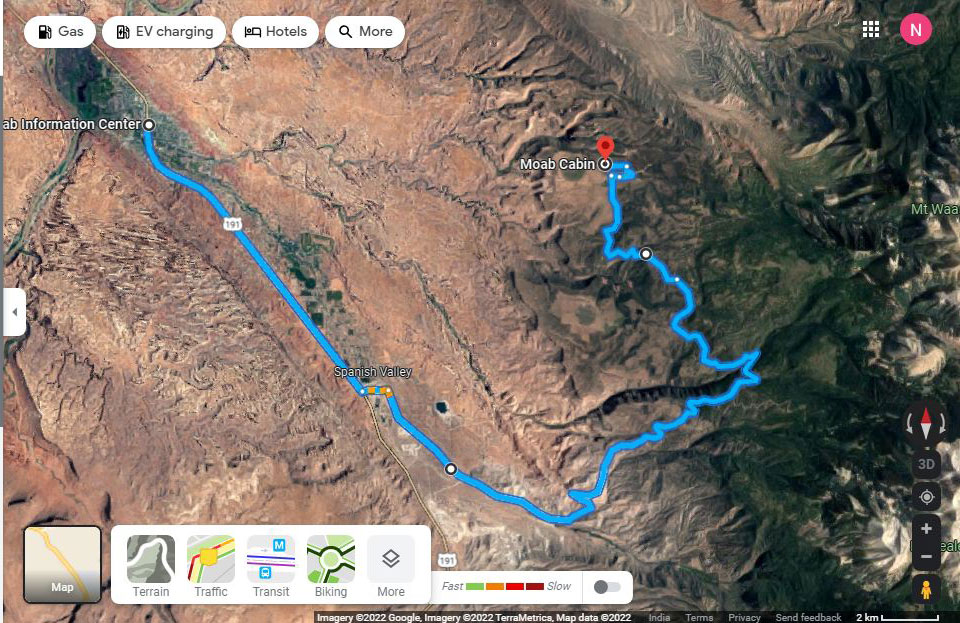
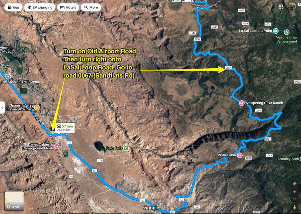
LaSal Loop Road route
Description
- To approach the cabin on the LaSal mountain loop road...Starting from N Main St/State Route 191
1 Head south on N Main St/State Route 191/US-191 S toward E Center St - go 7.8 mi
- Continue to follow US-191 S
2 Tum left at County Rd/Old Airport Rd - go 0.6 mi
3 Tum right at La Sal Mountain Loop Rd/Spanish Valley Dr-go 11.5 mi
- Continue to follow La Sal Mountain Loop Rd
4 Continue onto Wilson Mesa Rd - go 1.3 mi
5 Tum left at La Sal Mountain Loop Rd/Mountain Loop Rd -go 3.8 mi
- Continue to follow Mountain Loop Rd
6 Tum left at Sand Flats Rd - go 4.0 mi
7 Tum right to stay on Sand Flats Rd - go 0.7 mi
8 Tum left - go 0.5 mi
- Destination will be on the right
- Arriving at Moab Cabin
- Total: 30.3 mi - about 1 hour
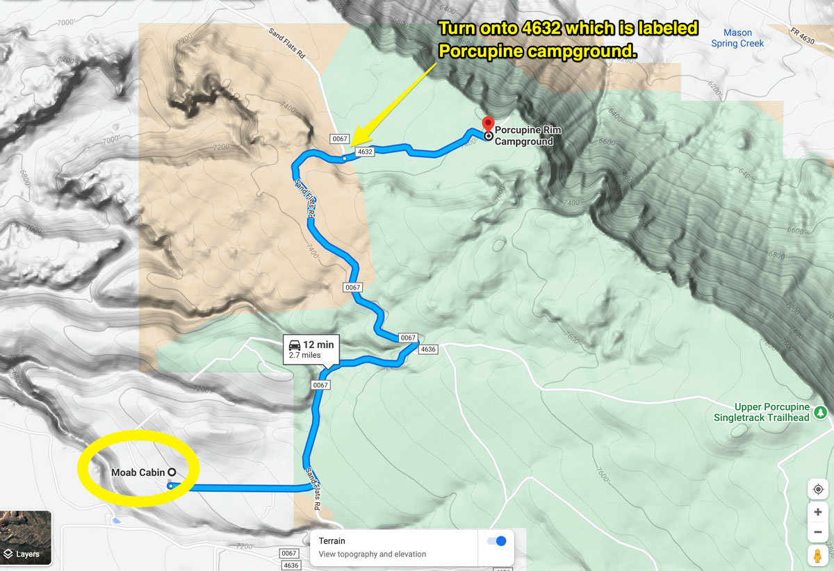
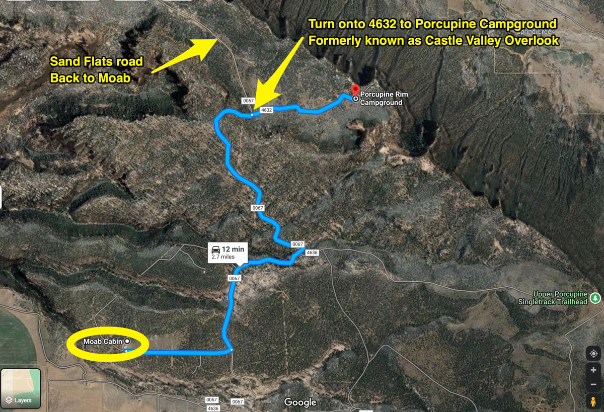
Castle Valley Overlook/Porcupine campground